The strongest way to walk Jalan Besar is to follow National Heritage Board’s tale of two former swamps: the Rochor River floodplain and the Kallang Basin. Choose stops that show water management, migration, worship, industry and leisure rather than trying to collect every marker. National Heritage Board Jalan Besar Heritage Trail. National Heritage Board Jalan Besar Stadium. Roots Jalan Besar neighbourhood brochure.
Choose the branch that matches your case
| Situation | Next step |
|---|---|
| Have about one hour | Choose four central stops around Jalan Besar and Rochor |
| Want industrial history | Prioritise former factories, workshops and river-edge change |
| Want community history | Pair places of worship with housing and commerce |
| Weather or mobility limits the walk | Use a shorter accessible cluster and read the official trail at home |
Begin with the ground under the streets
NHB describes a floodplain north of the Rochor River and muddy land around the Kallang Basin. Reclamation turned mangrove and nipah areas into streets, shophouses, institutions and housing. National Heritage Board Jalan Besar Heritage Trail.
Start the walk by locating the nearest canal or former shoreline on the official map. Water explains why the district developed as it did.
Use Jalan Besar as a connector
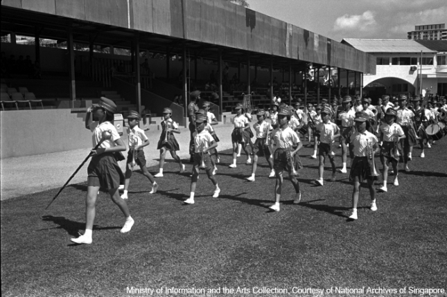
The road tied changing residential, industrial and entertainment zones together. Its name means big road, but the useful heritage question is what moved along it: workers, goods, worshippers and audiences. National Heritage Board Jalan Besar Stadium.
At each stop, record the historic function and the transport or community link it needed.
Read work through what has disappeared
The wider area once held slaughterhouses, refuse facilities, sawmills, oil mills, rubber factories and brick kilns. NHB notes the pollution and strong sensory impact around the rivers. Roots Jalan Besar neighbourhood brochure.
Do not romanticise industry as attractive heritage. Ask who worked there, what the city needed and what environmental cost followed.
Make New World the leisure hinge
New World drew audiences to singers, dancers and other live entertainment when such venues were central to urban recreation. Nearby beverage production also supported the district’s everyday economy.
Use the stop to compare paid leisure then with the restaurants, shops and cultural venues that attract visitors now.
Look for institutions that stayed
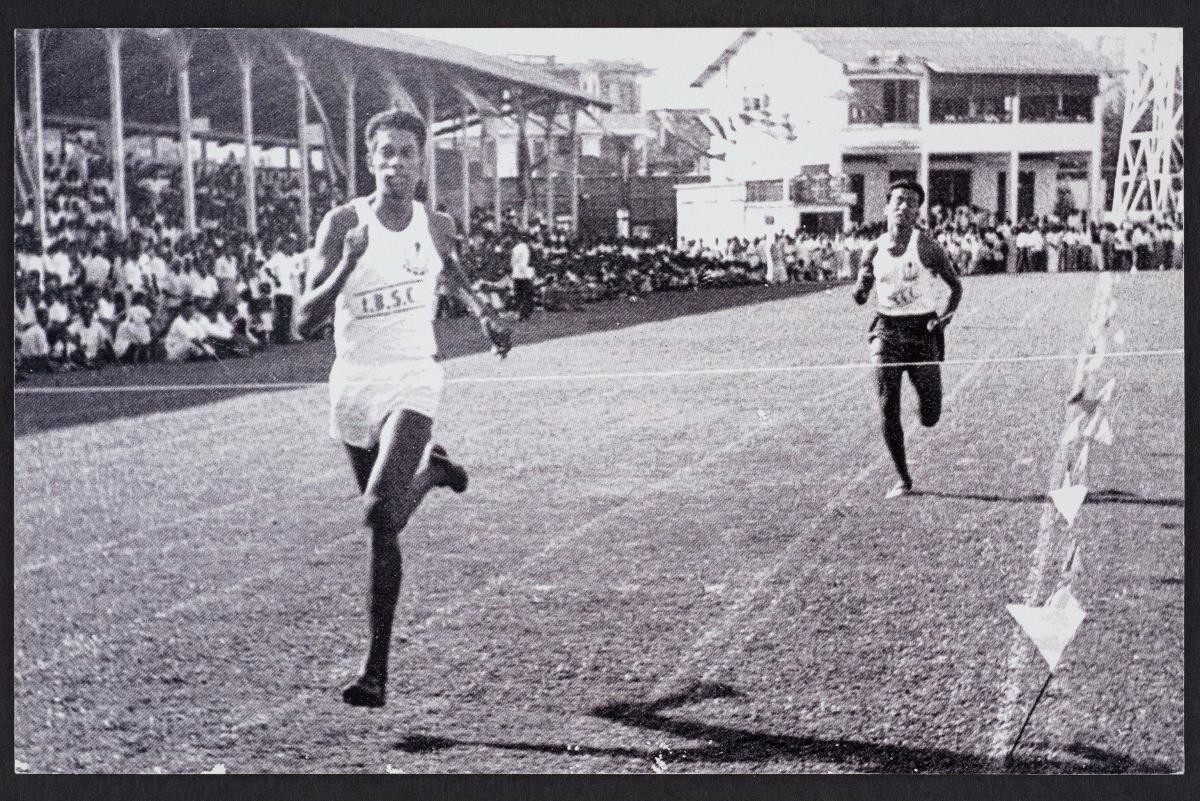
Temples, churches, schools, hospitals and the stadium show how communities established durable services as farmland and villages gave way to urban development.
Respect active worship and private property. Observe from public space unless a place clearly welcomes visitors, and follow photography rules.
Build a four-column field note
For each stop, note the documented past, what is visible now, the urban function and one question. Keep source facts separate from personal observation and date every observation.
This article claims no fresh field visit. Conditions, tenants and access can change, so the official trail and signs control historic claims.
Choose a route that works in the heat
A selective cluster beats a long exposed march. Start earlier, carry water, use sheltered streets and plan an MRT or bus exit near the final stop.
Singapore rain can make pavements slippery and canal edges uncomfortable. Pause the route rather than forcing it.
Finish by comparing two transformations
At the end, compare how the Rochor side and Kallang side changed from wet ground into different urban uses. Note which functions vanished, which moved and which institutions persisted.
That comparison turns a walk into an explanation of the district rather than a sequence of plaques.
Build a dated decision record
Write down the exact outcome you need: choose a compact set of stops that explains how water, work, worship and leisure shaped the district. Keep the household, company, product, trip or booking facts that produced the result beside it. A result based on different facts is not a precedent, even when the headline issue looks similar.
Record the date and the controlling page you checked. For this decision, the source set is National Heritage Board Jalan Besar Heritage Trail; National Heritage Board Jalan Besar Stadium; Roots Jalan Besar neighbourhood brochure. Save the relevant reference number, model, class, property detail, deadline, service route or ticket choice. That makes it possible to reconstruct the decision if a rule, inventory position or personal fact changes.
Use two working aids instead of a single yes-or-no note. First, make a water-work-worship-leisure stop filter. Second, add a four-column source-versus-observation field note. The first shows how the facts map to the official rule or live service; the second exposes the timing, cost, trade-off or follow-up action that a simple eligibility answer can hide.
Set a stop condition before acting. Pause if you encounter trying to visit every marker, romanticising polluted industry, claiming an unmade observation, or if any fact no longer matches the source you checked. Re-run the relevant official tool or contact the competent organisation. The purpose of the record is not paperwork for its own sake. It prevents an old screenshot, rough estimate or remembered rule from becoming an expensive assumption.
Work the example before the real decision
A walker chooses four stops representing water, work, worship and leisure. At 12 minutes per stop plus roughly 20 minutes of walking, the working duration is 68 minutes. This is an LBRD planning estimate, not an NHB official duration, and weather or access can extend it.
Reader checklist
- Open the official trail map
- Choose four contrasting stops
- Start from a water feature or former shoreline
- Record past and present separately
- Respect active premises
- Carry water and a rain plan
- End near public transport
Mistakes to avoid
- Trying to visit every marker
- Romanticising polluted industry
- Claiming an unmade observation
- Entering private compounds
- Using a cafe list as the heritage structure
Related next reads
After choose a compact set of stops that explains how water, work, worship and leisure shaped the district, take a compact Orchard history walk. You can also read another district through its built heritage.
Questions readers ask
What is the trail’s main frame?
The development of two former swamps around Rochor River and Kallang Basin.
Is a field visit claimed here?
No. The route is source-led and observations must be dated by the walker.
Must every stop be covered?
No. A selective route can explain the district more clearly.