
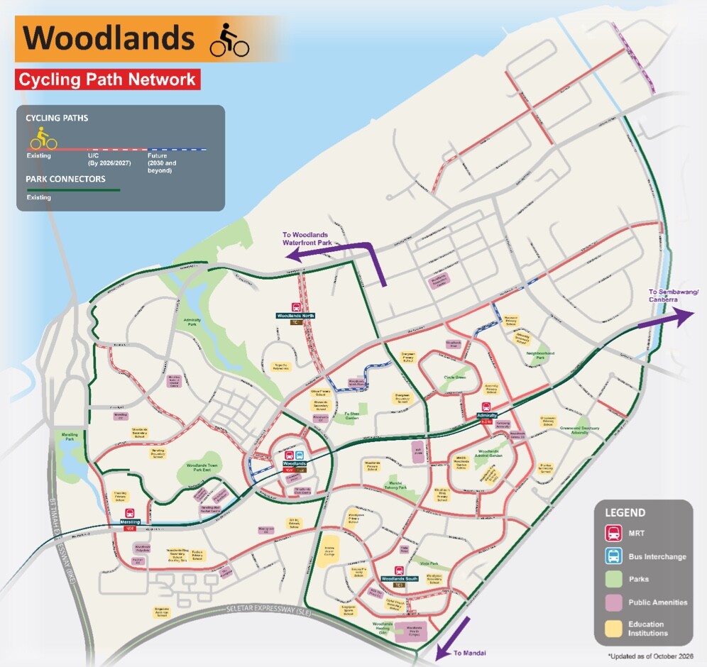
About 16km of new Woodlands cycling paths are now complete, the Land Transport Authority (LTA) announced on 14 November 2026. They join 26km of existing paths and park connectors in the town, which makes a network of roughly 42km. Residents can now cycle to Admiralty, Marsiling, Woodlands and Woodlands South MRT stations.
Where the Woodlands cycling paths take you
LTA says the network serves residents of Sembawang West, Sembawang and Marsiling-Yew Tee. Existing paths already connect to Sembawang and Canberra MRT stations. Along the way, you can reach these places by bike:
- Woodlands Civic Centre and Causeway Point
- Kampung Admiralty and The Woodgrove
- Woodlands Health Campus
- Republic Polytechnic
- Woodlands Waterfront Park
The paths also plug into the wider Park Connector Network and the first phase of NParks’ Round Island Route. From there, LTA says riders can reach Yishun, Punggol, Changi Village, East Coast and Marina Bay.
Safer crossings and more parking
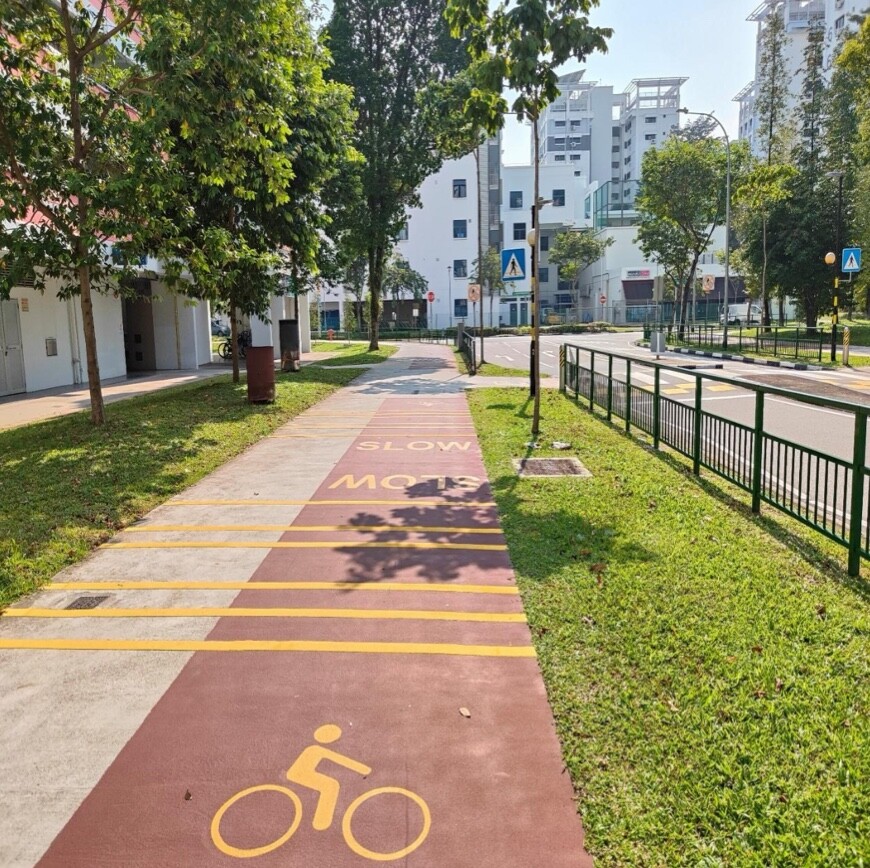
The works went beyond painting new lanes. LTA converted about 2.4km of open drains to covered drains to free up space for walking and cycling. It also adjusted some school boundaries where needed, while keeping safe access for students and other path users.
For anyone who walks, rides or waits for a bus along these routes, the safety changes are specific:
- 35 pedestrian crossings widened
- A new raised zebra crossing along Woodlands Drive 52
- Eight mid-block signalised pedestrian crossings converted into bicycle crossings
- 44 nearby bus stops upgraded with bypass paths
- About 500 bicycle parking lots added at Admiralty and Marsiling MRT stations
The parking matters if you plan to ride to the station and take the train from there. Admiralty and Marsiling are the two stations that get the new racks.
Health perks on the route
The Health Promotion Board (HPB) is working with grassroots and community partners on activities such as brisk walking clubs, which have drawn more than 600 participants so far. A launch event on 14 November brought out about 400 people, including more than 40 cyclists on a 7.2km ride from Woodlands to Sembawang. Others did a 1.7km brisk walk around ACE The Place Community Club.
Healthy 365 Nearby lets walkers and riders earn Healthpoints by checking in at designated spots on the brisk-walking route. More than 7,500 users in the North have checked in at least once at physical activity locations. If you want free classes to go with your rides, see our guide to HPB MOVE IT classes at The Kallang.
Planning a ride
The map in LTA’s release is updated as of October 2026 and marks paths that are existing, under construction (by 2026 or 2027) and planned for 2030 and beyond. Park connectors show up in a separate colour. Check it before you set out, because some of the 9km still to come will not be ready until 2027.
Riders sharing paths with walkers should still keep to a sensible speed. The painted SLOW markings in LTA’s photos are there for a reason, especially near crossings and bus stops.
What is next
About 9km more cycling paths in Woodlands and Sembawang will be completed progressively from 2027. They include links to the upcoming Johor Bahru-Singapore RTS Link station. LTA expects Woodlands to have one of the largest intra-town cycling networks in Singapore once everything is done.
Nationwide, the cycling network has grown from about 600km in 2024 to more than 800km today. LTA targets about 1,300km by 2030, and says more than 9 in 10 HDB residents should then be within minutes of their nearest cycling path. It will also review and expand bicycle parking at key transport nodes.
The release describes infrastructure only and does not set out new rules, so check LTA’s active mobility pages for the current rules on bicycles and personal mobility devices. If you are heading to the MRT after your ride, remember that fares go up soon, which we cover in our note on the bus and MRT fare rise on 26 December 2026.